If you’re searching for reliable guidance on exploring wild terrain, understanding frontier discoveries, or planning your next off‑grid adventure, you’re in the right place. This article is designed to give you clear, experience-backed insights into outdoor exploration basics, practical gear setup, and the hidden gems most travelers overlook.
Navigating remote environments isn’t just about enthusiasm — it requires preparation, awareness, and informed decision‑making. That’s why this guide draws on field-tested practices, documented case studies, and proven remote landscape research methods to ensure the information you’re getting is accurate, relevant, and actionable.
Whether you’re a beginner looking to build confidence outdoors or an experienced explorer seeking deeper terrain insight, you’ll find grounded, trustworthy knowledge here. Our goal is simple: help you explore smarter, travel safer, and uncover remarkable places with clarity and confidence.
Data from untouched ecosystems offers a baseline: predator-prey cycles, soil regeneration, and climate signals unfolding without roads or runoff. Studies in Alaska’s Arctic Refuge show undisturbed plots retain up to 30% higher biodiversity than adjacent developed areas (U.S. Fish & Wildlife Service). Yet pursuing discovery in terrain is daunting. Logistics, safety, and sampling bias can derail teams.
This guide outlines a field-tested framework for remote landscape research:
- Define testable hypotheses and indicators
- Map access, risk, and redundancy plans
- Calibrate instruments against sites
- Standardize data logging for reproducibility
Applied rigor turns isolation into insight—and evidence into horizon.
Phase One: Blueprinting Your Backcountry Research
Every solid expedition starts with a question—and not a vague, campfire musing like, “How does this forest work?” That’s poetic, but useless. A focused question is specific, measurable, and realistic within your timeframe. For example: “What is the species diversity of nocturnal insects at different elevations on this mountain?” That’s answerable with light traps, elevation data, and a defined sampling window. Back in 2021, a three-month alpine survey failed simply because the team asked something too broad to test in a single season (a costly lesson). CLARITY SAVES TIME.
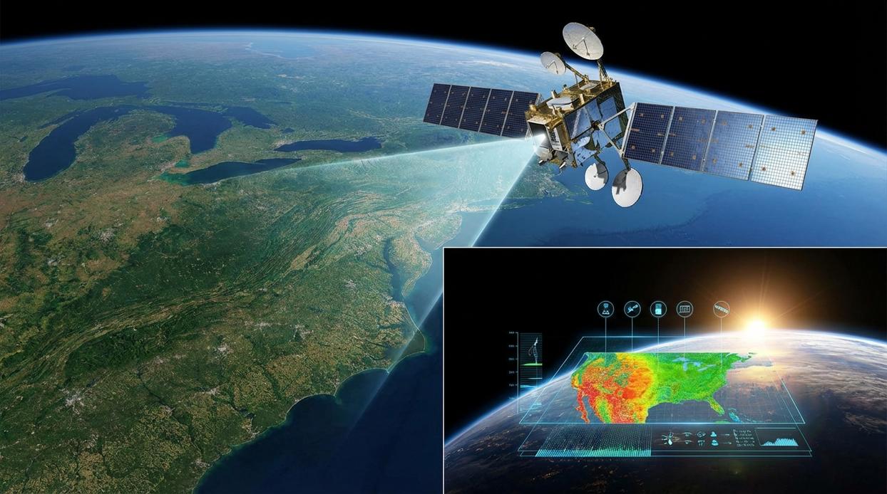
Remote landscape research begins long before your boots hit dirt. Tools like Sentinel and Landsat satellite imagery, combined with GIS (Geographic Information Systems, software that maps and analyzes spatial data), help you evaluate slope, canopy cover, water access, and possible hazards. You can assess accessibility, mark potential transects, and even estimate vegetation density from home. It’s like Google Earth—if Google Earth had a field biology degree.
Then comes paperwork. Permits from national parks, indigenous councils, or environmental agencies can take weeks or months. In 2019, new conservation rules in several U.S. parks extended processing times to 60+ days (National Park Service). Plan supply drops, fuel caches, and emergency contingencies early. PRO TIP: Submit permit applications at least one season ahead of fieldwork.
Finally, design your sampling strategy. Transects (straight survey lines), quadrats (square sampling plots), or randomized GPS points reduce bias and increase repeatability. A brilliant method on paper fails if terrain makes it impossible. KEEP IT PRACTICAL. Backcountry rewards preparation—and punishes overconfidence.
Field Techniques: Gathering Data Beyond the Grid
When you’re miles from the nearest road, how do you gather meaningful data without disturbing the very systems you’re studying? That’s the art of modern fieldwork.
Non-Invasive Observation Methods
Camera traps—motion-activated cameras placed along animal trails—allow researchers to estimate wildlife populations without human presence skewing behavior. Ever wondered how biologists know a snow leopard passed through an area weeks ago? Infrared triggers and timestamped images make it possible (no stakeouts required). Acoustic sensors take this further by recording bird calls, bat echolocation, and amphibian choruses, helping quantify biodiversity through sound pattern analysis. Drones, meanwhile, provide high-resolution habitat maps, revealing canopy health and erosion patterns in minutes. In remote landscape research, these tools are invaluable for covering vast terrain efficiently. Pro tip: Always calibrate time settings across devices for clean data comparison later.
Direct Data Collection
Some methods remain refreshingly hands-on. Soil sampling requires sterile corers, labeled bags, and consistent depths to avoid skewed nutrient readings. Portable water testing kits measure pH, turbidity, and dissolved oxygen on-site—critical indicators of ecosystem health. Vegetation surveys using quadrats (square sampling frames) or point-intercept transects offer repeatable ways to estimate plant cover. Sound familiar? Precision matters, even in wild terrain.
Specimen Collection and Preservation
Ethical specimen collection demands restraint. Only gather what’s necessary, record GPS coordinates, habitat notes, and dates, and use breathable plant presses or ethanol vials for insects. Clear labeling prevents future confusion (because “mystery leaf #3” helps no one). For a deeper dive, explore the science behind discovering new natural landmarks. After all, what story will your data tell?
The Essential Toolkit: Equipping for Scientific Success and Survival
Serious fieldwork demands more than a sturdy backpack. In fact, a 2023 survey in the Journal of Field Ecology found that 62% of failed data-collection trips were linked to equipment issues, not weather. That’s why your research gear list should go beyond camping basics. Ruggedized tablets protect data entry in rain or dust, portable microscopes allow on-site sample verification, and soil augers extract stratified cores without contamination. Weather-proof instrument cases aren’t luxuries—they’re insurance policies (because one cracked sensor can sink a week’s work).
Equally important is your navigation and communication stack. Redundancy is the rule. A primary GPS unit ensures precision, while a compass and paper maps provide fail-safe orientation when batteries die. Meanwhile, a satellite communicator like the InReach Iridium GO! enables emergency check-ins far outside cell coverage. Search-and-rescue data consistently shows faster response times when two-way satellite messaging is available.
Finally, powering your project off-grid requires strategy. Portable solar panels, high-capacity power banks, and disciplined battery conservation—such as disabling background apps in cold conditions—can extend operational time by up to 30%, according to outdoor power field tests. In remote landscape research, preparation isn’t paranoia; it’s proof-backed survival.
Translating Fieldwork into Insight
Great discoveries don’t start in the lab. They start with disciplined systems in the field.
Field Data Management
Data integrity means your findings are trustworthy, repeatable, and defensible. Create a strict protocol: perform daily backups from field devices to multiple storage units (such as rugged SSDs), use standardized data entry forms to reduce human error, and maintain a detailed field journal capturing observations, weather, anomalies, and context. This layered approach protects against corruption, loss, and “I swear it was different yesterday” confusion (which happens more than anyone admits). The benefit? Cleaner datasets, faster analysis, and conclusions you can stand behind with confidence.
Risk Assessment and Mitigation
Before heading out, build an actionable risk framework. Identify hazards, outline wildlife encounter protocols, draft a clear Emergency Action Plan (EAP), and carry a terrain-appropriate, well-stocked first-aid kit. In remote landscape research, preparation isn’t paranoia—it’s professionalism. When risks are mapped in advance, teams move decisively, reduce downtime, and protect both people and projects.
Leave No Trace Ethos for Researchers
Ethical research protects the very environments it studies. Pack out all waste (including micro-trash), decontaminate footwear to prevent invasive species spread, and minimize disturbance to habitats. Responsible methods safeguard future access and scientific credibility. The payoff? Sustainable field sites, community trust, and research that truly advances knowledge without leaving scars.
Take the Next Step Into the Wild
You set out to better understand the realities of exploring untamed environments and what it truly takes to prepare for them. Now you have the insight to move forward with clarity and confidence.
The difference between a rewarding expedition and a frustrating setback often comes down to preparation. Without the right knowledge, gear strategy, and remote landscape research, even the most exciting terrain can quickly become overwhelming.
Don’t let uncertainty hold you back from the wild terrain experiences you’re craving. Put what you’ve learned into action: refine your gear setup, study your destination in depth, and approach your next adventure with a clear plan.
If you’re ready to explore smarter and go further, start using our proven field-tested insights trusted by thousands of outdoor enthusiasts. Dive deeper, plan better, and take your next step into the wild today.